
Hi everyone. Just wondering how the beaches weathered tropical storm Ida. Especially Seagrove Beach. Garrett Realty said the steps down to the beach had to be extended due to the erosion of that much sand below the steps. I did not think we got hit that hard, so I was looking for verification. Anybody have first hand information?
Replies
15
SoWal Expert
I saw pictures of a huge exposure of peat in Seagrove- it looked like it went from the dune line to the waterline- not sure exactly where. It was on a friend's FB who lives in SGB.

Beach Fanatic
I was walking the Grayton beach last night and had the impression that sand was deposited on the beach. Anyone else have that impression? Was it wishful thinking?

Beach Fanatic
I'll be curious to see the official reports or hear from BSiO2. Looked like there was a lot of sand pushed up and added from what I saw. Even some of the walkover steps looked like they had sand over a few more steps than before the storm. Perhaps they were built back further than some steps that people have reported sand missing.

beats on hood
I saw pictures of a huge exposure of peat in Seagrove- it looked like it went from the dune line to the waterline- not sure exactly where. It was on a friend's FB who lives in SGB.There is always an area from One Seagrove Place to Legacy where storms expose a lot of peat. But the beach in front of our part of Seagrove never gets that.
I'll be curious to see the official reports or hear from BSiO2. Looked like there was a lot of sand pushed up and added from what I saw. Even some of the walkover steps looked like they had sand over a few more steps than before the storm. Perhaps they were built back further than some steps that people have reported sand missing.Like I said on another thread, we had some erosion around the walkover, but everything else looks great, thank goodness.
Beach Lover
i remember staying at beachcrest in seagrove beach a few years ago after a storm hit and the black peat exposed looked like a oil tanker spilled a million gallons of oil.It looked like a new jersey beach.

Beach Lover
This Walton Sun article has a roundup from various points, including the Whale's Tail and Rosemary:
Ida a low blow in South Watlon (PHOTOS) | photos, area, reports - Local News - WaltonSun.com
There was also some erosion in Inlet Beach, under that road (Pompano St., I think) the county just spent who knows how much $ rebuilding.
Ida a low blow in South Watlon (PHOTOS) | photos, area, reports - Local News - WaltonSun.com
There was also some erosion in Inlet Beach, under that road (Pompano St., I think) the county just spent who knows how much $ rebuilding.
SoWal Expert
i remember staying at beachcrest in seagrove beach a few years ago after a storm hit and the black peat exposed looked like a oil tanker spilled a million gallons of oil.It looked like a new jersey beach.
From the picture I saw, it looks like a big brown island on the beach.
Beach Fanatic
I'll be curious to see the official reports or hear from BSiO2. Looked like there was a lot of sand pushed up and added from what I saw. Even some of the walkover steps looked like they had sand over a few more steps than before the storm. Perhaps they were built back further than some steps that people have reported sand missing.
Since you asked..;-)
That Brad Pickel guy quoted in the paper hit most of what I would say, but generally speaking it was a mixed bag this time. There was definitely some beach profile lowering in Seagrove where the peat was uncovered, but there was also some toe of the dune building in other areas (look on the Destin Log website at Whale's Tail- they got sand).
In western Walton County, most of the beach fared very well, but areas where the beach was narrow to begin with had dune impacts. Along 30-A in areas that were already narrow before the storm (Blue Mountain, Old Seagrove, Dune Allen), we saw some dune scarping but nothing like we have seen with some of the hurricanes. I guess there's not a cut and dried answer this time except to say that the more distance there is from the water to the dune, the less the impact.
I personally believe that the majoity of the sand that was eroded from the beaches and dunes is not "lost" this time, but is in the nearshore areas and will have a VERY good opportunity to be pushed back on shore with the winter and spring waves. I think you could see some wide flat beaches in December and January that are perfect for a stroll so make sure and enjoy them.

Beach Fanatic
Our walkover had one support loosened and canted but no other damage. Our beach is definitely wider than it was, almost out to the first sandbar. It looks wonderful now but as anyone who lives on or close to the beach knows, it can change almost overnight. Right now it is beautiful!

Beach Fanatic
My impression of the beach near Eastern Lake is that it is wider, and that sand has been deposited on top to raise it. For sure, the lake outfall is FULL of sand.

SoWal Expert
The beach/shore are natural - change is part of that.
I've got a functional walkway, white (oil free) sand, plenty of room for me to enjoy the beach, and a gorgeous view of water (sans oil rigs).
As long as that is the case, the vagaries of sand and waves don't bother me much.
I've got a functional walkway, white (oil free) sand, plenty of room for me to enjoy the beach, and a gorgeous view of water (sans oil rigs).
As long as that is the case, the vagaries of sand and waves don't bother me much.
beats on hood
From the picture I saw, it looks like a big brown island on the beach.Not so. I have walked twice from Eastern Lake to Jasmine Dunes. Never saw anything that was a big deal. I have photos, but I am too lazy to upload them.

SoWal Expert
Not so. I have walked twice from Eastern Lake to Jasmine Dunes. Never saw anything that was a big deal. I have photos, but I am too lazy to upload them.
That's good to hear- maybe it got covered again quickly. In the picture, a person was standing on it for perspective and it was really awful.

Beach Fanatic
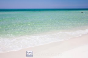
Photos from Sunday Nov 15, I was near Seagrove/Bramble (sp?) access and walking towards Seaside. The scene was different every few hundred feet, some areas appeared to have sand deposited. Hopefully, Mother Nature will repair it soon enough. For now, the beach is flat and made for power walking.
Edited
Beach Fanatic
An unfortunate consequence of Ida was the wonderful sand buildup at Eastern Lake. This resulted in the lake being forced open and dug out for unqualified reasons, immeho. As in last time this happened, the trigger point, which is too low in a number of estimations, had not even been breached. The last time the lake was in this wide sandbar configuration, it took about 5 months to open (backed up by individual with measurements and statistics), but it did open naturally. The sand is also piled up along the west side of the digout which blocks the water from breaking down the sand efficiently in that direction. This situation really must be revisted and re-evaluated. Why, really why, was it opened? Camp Creek is open. Nice meandering opening to the west. Deer Lake, protected as a state park from this kind of activity, has a similar sand bar buildup as Eastern Lake did.
Edited
Checking your forum account
Please wait while we verify your forum account.