Hurricane Isaac
- Thread starter Kurt
- Start date
-
Trouble logging in? Send us a message with your username and/or email address for help.
You are using an out of date browser. It may not display this or other websites correctly.
You should upgrade or use an alternative browser.
You should upgrade or use an alternative browser.
New posts


I agree with this idea. We are not really gonna know until tomorrow afternoon.


New posts
This is Sheriff Michael Adkinson, Jr. notifying you of the current Emergency Management preparations for Tropical Storm Isaac. We are now issuing a voluntary evacuation order for all non-residents and visitors in Walton County south of Hwy 20.
A mandatory evacuation will be issued at 3:00 pm CST today for residents of Walton County in low lying areas south of Hwy 20. Current forecasts indicate that Walton County will experience tropical storm force winds by 5:00 pm Monday August 27, 2012. The Clyde B. Wells Bridge will close when the wind reaches a sustained 40 mph. Again, this is expected to be at 5:00 pm Monday evening.
You may want to take this opportunity to postpone Wednesday, August 30th arrivals until Thursday, August 31st we will continue to provide updates on conditions as we receive them.
For further information, please call our citizen information hotline at 850-892-8394 or 850-892-8392.
Emergency Meeting: WCBCC and WCSO - Local State of Emergency
The Walton County Board of County Commissioners has called an emergency meeting for Sunday August 26th at 1:00 pm at the Courthouse in Defuniak Springs, FL.
This meeting is to be held in combination with the Walton County Sheriff's Office to declare a local state of emergency.
The Walton County Board of County Commissioners has called an emergency meeting for Sunday August 26th at 1:00 pm at the Courthouse in Defuniak Springs, FL.
This meeting is to be held in combination with the Walton County Sheriff's Office to declare a local state of emergency.
A reminder that if necessary we will create a dedicated Isaac forum. We have a plan in place for emergencies. We have posts already in place with links and other sources of information, and will be relying on everyone in the community to help and share as usual. Thank you!
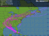
Less confidence than usual in the track. From Masters new post this morning:
http://www.wunderground.com/blog/JeffMasters/comment.html?entrynum=2206
The latest set of 0Z and 06Z (8 pm and 2 am EDT) model runs have diverged significantly, and we can no longer be confident we know where Isaac will make landfall on the Gulf Coast. One camp of models, the UKMET and ECMWF, predict that a trough of low pressure moving across the Southeast U.S. will be strong enough to turn Isaac north to a landfall in the Florida Panhandle. The other set of models, the GFDL, GFS, and HWRF, predict the trough will bypass Isaac, and a ridge of high pressure will build in and force Isaac to a landfall over Louisiana. The official NHC forecast averages out these two extremes, calling for a landfall midway between the two solutions.
And:
The intensify forecasts from the various models are very divergent. The latest 06Z (2 am EDT) run of the GFDL model keeps Isaac as a strong tropical storm until landfall in Louisiana. Isaac will undergo rapid intensification into a Category 3 hurricane as it hits New Orleans, says the latest 06Z (2 am EDT) run of the HWRF model. The ECMWF model has Isaac as a strong Category 2 storm with a central pressure near 950 mb as it hits near the Alabama/Florida border.
I agree with this idea. We are not really gonna know until tomorrow afternoon.
For Beach Runner:
Models are not in agreement. Here is the Euro - it's an animation, wait for it to load. This is one of the better performing models. It still has us as the bull's eye. The uncertainty has to do with a turn up towards us.
http://www.ecmwf.int/products/forec...a!pop!od!oper!public_plots!2005101800!!!step/
Um, what exactly does a mandatory evacuation mean?
We've got guests in Seagrove, at Hidden Beach Villas, Cassine Station, and gulf front at Ramsgate. It's a beautiful day. All were planning on leaving Monday am.
I appreciate the Sherriff being proactive, but this seems a little premature on very short notice, especially with winds and waves not really expected to be hitting the area until Monday afternoon. Not to mention the forecast track seems to keep shifting further west today.
If our guests don't start out until tomorrow before noon, are they really at risk of getting stuck at the 331 bridge? What if they went east on 98 through Panama City instead, or West and across the mid-bay bridge. What are the closing policies on those bridges?